
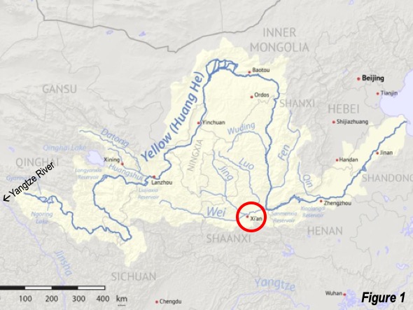
Xi’an (pronunciation) is located in central China, on the Wei River, a tributary of the flood-prone Yellow River (Huang He). Xi’an is at the bottom of the “Ordos Loop” (see Surprising Ordos: The Evolving Urban Form), which is formed by the Yellow River’s sharp northward turn upstream at Lanzhou, toward Inner Mongolia (Nei Mongol). From there the river turns sharply south, and then eastward toward the Pacific Ocean at the confluence of the Wei River, 130 kilometers (80 miles) from Xi’an (Figure 1, Xi’an location circled in red).
This is one of the most important cities in history. The Xi’an urban area housed capitals of 13 imperial dynasties over two millennia.
Haojing-Fenging: The Western Zhou Dynasty
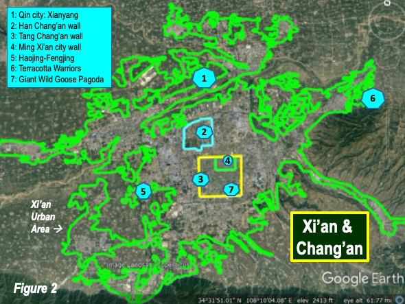
The first was Haojing-Fengjing (#5 on Figure 2, the contemporary Xi’an urban area map), which was the capital of the Western Zhou dynasty, from 1046 to 771 BC and straddled the Fen River. George Modelski (World Cities: -3000 to 2000) suggests that at the time Haojing-Fengjing was the largest city in the world, with 125,000 residents in the 9th and 10th centuries BC (Note).
Xianying: The Qin Dynasty
Five centuries later (221 BC), after the “warring states” period, the Qin dynasty, China’s first imperial dynasty placed its capital in Xianyang. One of the world’s leading historical sites, the Terracotta Warriors (#5 on Figure 2) was a product of the Qin, despite the dynasty’s short15 year life. Xianyang is now a separate municipality (prefecture), and has recently been engulfed by the expansion of the Xian urban area (#1 on Figure 2).
Chang’an: The Western Han Dynasty
The Qin dynasty was replaced by the Western Han dynasty, which held power until 9 AD. The Western Han moved the capital to the first site of Chang’an less than 15 kilometers (10 miles) away, between modern Xianyang and Xi’an (#2, Figure 2).
University of California Han Dynasty expert Michael Nylan described Chang’an, with Rome, as one of the two greatest cities of the classical world, the other being Rome, in her George E. Morrison Lecture at the Australian National University in 2016 (video here). Professor Nylan noted that at the time Chang’an had nearly three times as many residents as Rome. With 200,000 residents in 200 BC according to Tertius Chandler (Four Thousand Years of Urban Growth: An Historical Census) the Xi’an area again contained the largest city in the world.
Han Chang’an was a walled city, enclosing 36 square kilometers (14 square miles), but had substantial suburbs outside the walls.
Chang’an: The Tang Dynasty
Chang’an became capital again (581-907 AD) under the short-lived Sui Dynasty and its successor Tang Dynasty, in what has been called China’s Golden Age. This was a new Chang’an, located just to the southeast of the former Western Zhou city. Tang Chang’an was also walled (#3 in Figure 2), enclosing 78 square kilometers (30 square miles). This is approximately 90% as large as the ville de Paris inside the late 19th century wall.
Chang’an, however, faced periodic famines, which occasioned moves of the capital to Luoyang, 375 miles (230 kilometers) east.
According to the Ancient History Encyclopedia, during the 8th century, Chang’an had nearly “3 million inhabitants (one million inside the city walls and another 2 million in the surrounding suburbs.),” making it again the largest in the world. Chandler indicates that no city had reached this population until after 1850 (London, at 4.2 million in 1875). A more modest estimate was provided by renown Yale University China scholar Professor Arthur Wright in Arnold Toynbee’s Cities of Destiny, at one million inside the city walls and nearly another million outside in the suburbs.
National Dong Hwa University (Taiwan) Professor Timothy Baker’s GIS historical analysis of roadway remnants indicates that “Chang’an, as organized within its perimeter walls, was an integral part of a continuous spatial matrix that spread out from the city to the countryside for a distance of from five to ten kilometers” (3 to 6 miles). He also finds some evidence that the development may have reached north of the Wei River, which averages 15 kilometers (10 miles) beyond the north city wall.
This extent of urbanization could have accommodated two million or more residents. If, for example, suburban Chang’ were only half as extensive as Baker estimates, with a density half that inside the walls, a population well above 2 million could have been accommodated.
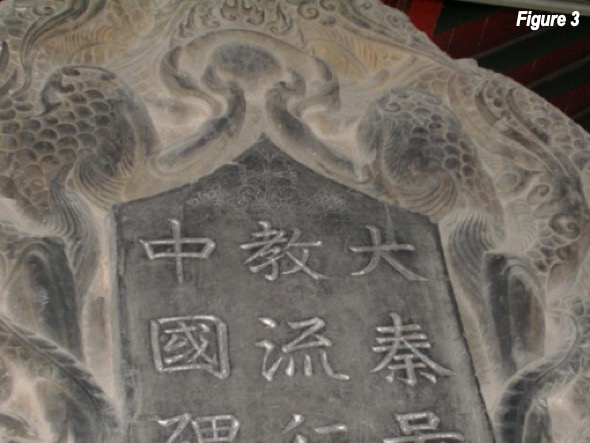
Chang’an was an important terminus of the principal “Silk Road,” the trade route connecting to the Middle East and the Mediterranean. This brought an unusual degree of diversity. Wright indicates that in the 8th century, there were more than 90 Buddhist Temples, 16 Taoist temples, 4 Zoroastrian temples and 2 Nestorian Christian churches, a history of which can be found on a “stele”--- a stone slab monument with text--- (Figure 3), in the Xi’an Stele Forest Museum.
Contemporary Xi’an
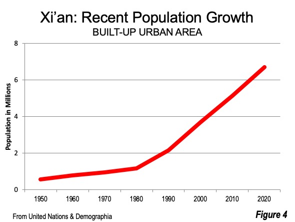
No longer the world’s largest urban center, Xi’an fell to a population of less than 600,000 in 1950, according to the United Nations. But the Xi’an urban area has far now exceeded peak, with 6.7 million residents in according to The Demographia World Urban Areas (Figure 4). Since 2010, Xi’an has continued strong growth, unlike most of the larger municipalities in China.
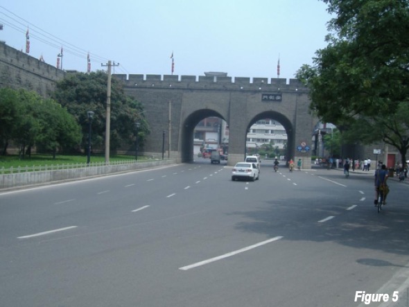
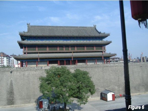
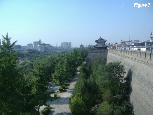
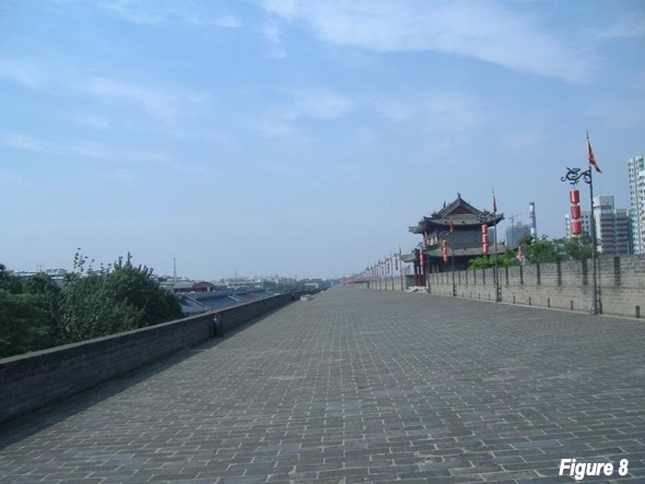
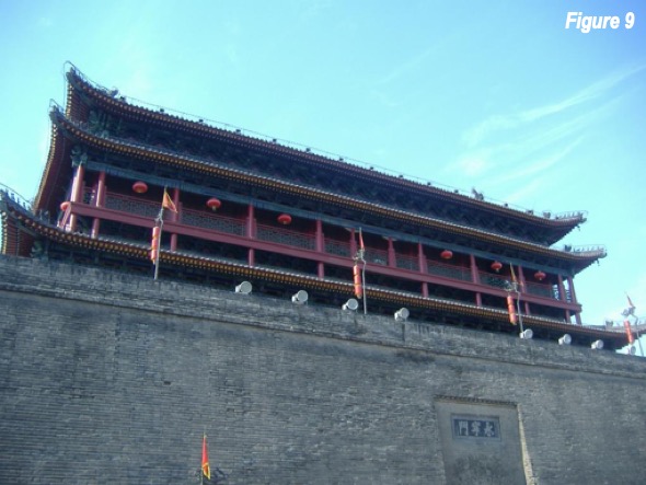
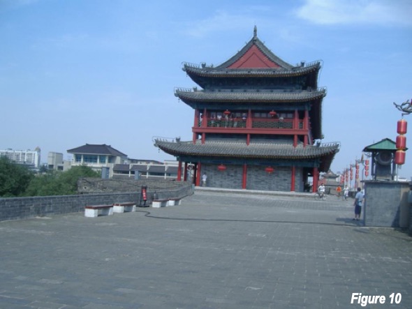
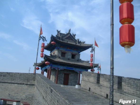
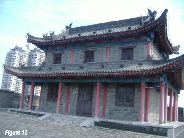
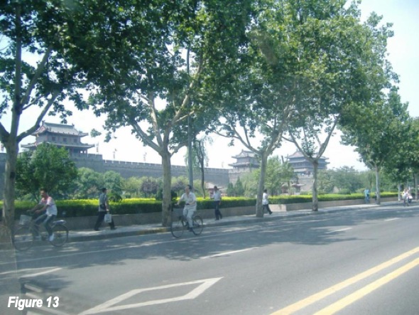
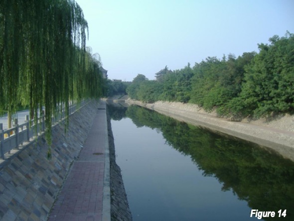
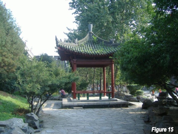
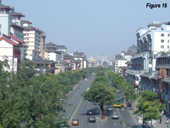
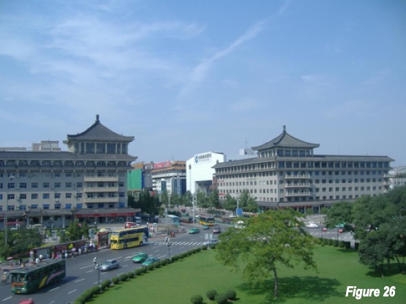
The modern urban core of Xi’an is surrounded by one of the one of the two best preserved city walls in China (#4 in Figure 2 and Figures 5 to 15), the other is in Nanjing. It has a perimeter of 13.7 kilometers (8 miles) and encloses an area of 14 square kilometers (5 square miles). Cycling around the top of the wall is a popular attraction, especially for tourists. North Street, toward the Bell Tower is shown from the wall in Figure 16.
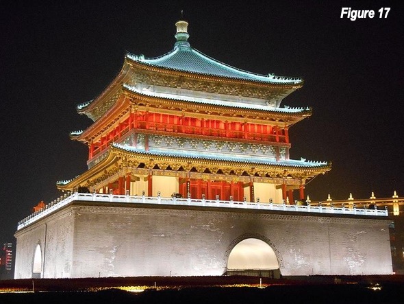
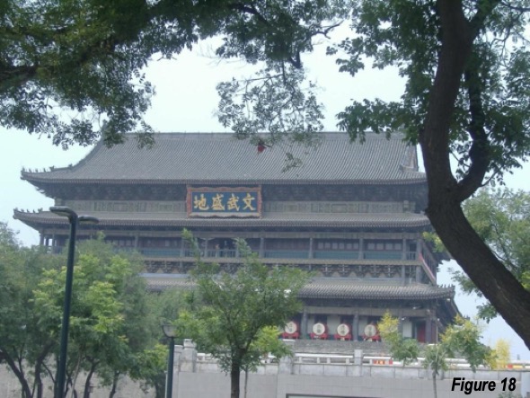
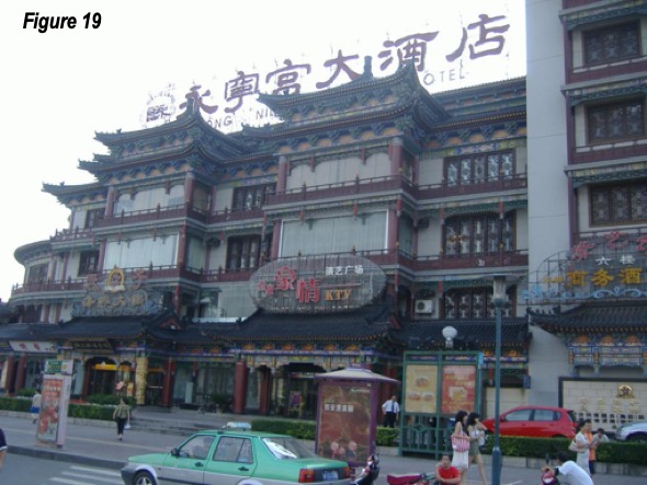
Xi’an is famous for its Bell Tower, which is located at the main intersection of the walled city (top photograph and Figure 17), where North Street, South Street, West Street and East Street converge. The Drum Tower is a couple of blocks away on West Street (Figure 18). Figure 19 is a street scene inside the city wall.
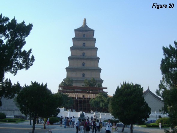
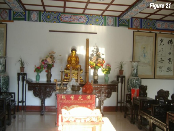
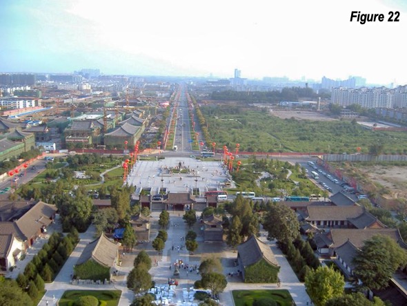
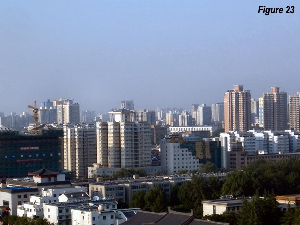
The Buddhist Giant Wild Goose Pagoda (#7 in Figure 2 and Figures 20-21) is located is the southeastern quadrant of the Tang walled city, well outside the present city wall. It was built more than 1,300 years ago and is 65 meters (211 feet) tall, the equivalent of a 20-story apartment building. The Pagoda provides good views of the city (Figures 22-23).
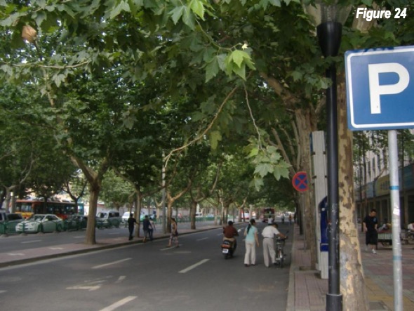
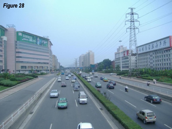
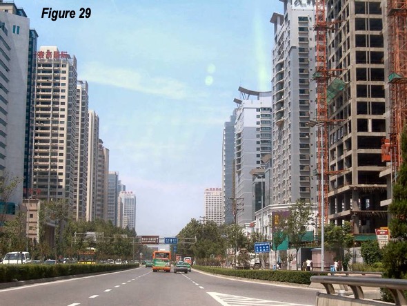
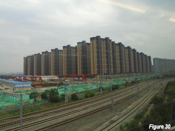
The southern suburbs are shown (outside the wall) Figures 24-28. North Street, outside the wall is shown in Figure 29, heading toward the Xi’an North Railway Station. Figure 30 is a residential development adjacent to the former north wall of Tang era Chang’an, just west of Xi’an North Railway Station.
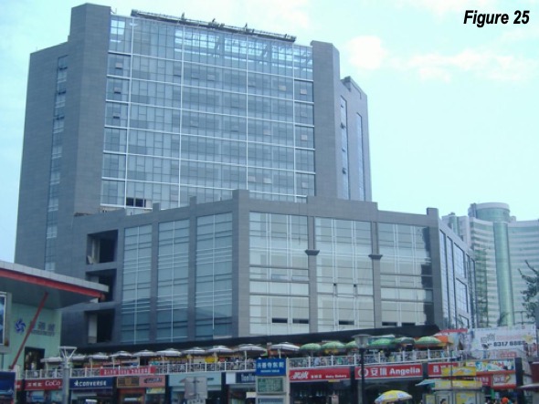
Xi’an, like other cities in China, has experienced significant skyscraper development, with 15 structures exceeding 500 feet (150 meters), the earliest built in 1999 (according to Emporis). The tallest, at 75 floors, has been topped out (Xi’an Glory Financial Center, photo here). Most of the new buildings are in the southwest quadrant, near the G-30 Expressway, a southern bypass. The new development is an “edge city” rather than a central business district, located outside the core, with liberally spaced towers.
Visiting Xi’an
Xi’an is the second most popular tourist destination in China, trailing only Beijing.
Xi’an is well served by the nation’s air and rail systems. Xi’an-Xianyang International Airport is undergoing a major expansion that will take its capacity to over 80 million annual passengers, more than London’s Heathrow. The flight time to Beijing is under 2.5 hours, and three hours to Shanghai and Guangzhou. Rail makes the trip from Beijing in under 6 hours, and it is less than 8 hours from Shanghai and 9 hours from Guangzhou. It may not be China’s largest or most important but may be the most historically significant along with Beijing, which has been the capital for nearly as long since 1421.
Note: There is considerable uncertainty about historic urban area population estimates, until about 1800, when modern censuses began.
Photo credit: Bell Tower, by author.
Figure 1: https://en.wikipedia.org/wiki/Ordos_Plateau#/media/File:Yellowrivermap.j...
Figure 2: Google Earth with author’s enhancements
Figure 17: https://upload.wikimedia.org/wikipedia/commons/1/1c/Bell_Tower_of_Xi%27a...
All other figures by author
Wendell Cox is principal of Demographia, an international public policy firm located in the St. Louis metropolitan area. He is a founding senior fellow at the Urban Reform Institute, Houston and a member of the Advisory Board of the Center for Demographics and Policy at Chapman University in Orange, California. He has served as a visiting professor at the Conservatoire National des Arts et Metiers in Paris. His principal interests are economics, poverty alleviation, demographics, urban policy and transport. He is co-author of the annual Demographia International Housing Affordability Survey and author of Demographia World Urban Areas.
Mayor Tom Bradley appointed him to three terms on the Los Angeles County Transportation Commission (1977-1985) and Speaker of the House Newt Gingrich appointed him to the Amtrak Reform Council, to complete the unexpired term of New Jersey Governor Christine Todd Whitman (1999-2002). He is author of War on the Dream: How Anti-Sprawl Policy Threatens the Quality of Life and Toward More Prosperous Cities: A Framing Essay on Urban Areas, Transport, Planning and the Dimensions of Sustainability.


