NWS survey: 10 tornadoes April 24 over Rolling Plains
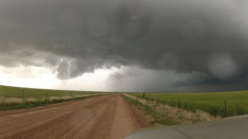
LUBBOCK, Texas (KCBD) - 10 tornadoes moved across parts of the Rolling Plains northeast and east of Lubbock on the evening of Thursday, April 24.
The National Weather Service issued a report on its storm survey.
Thankfully, we received no damage reports from these tornadoes; each one stayed outside of communities.
The ratings are listed below, all either EF-U or EF-0. EF-U stands for “unknown”. Tornado ratings are based on damage. Either because a tornado did not impact any structure, or because there wasn’t an easy way to access its path, some the tornadoes received this EF-U rating.
The full report below shows it’s plausible the first two tornadoes produced gusts that an EF-1 tornado would produce. The third, a longer-track tornado that moved Floyd into Motley County, was on the ground for 9.7 miles over 28 minutes. The Weather Service projects this tornado produced peak gusts in the range of 120 to 135mph, which would be either an EF-2 or EF-3.
Public Information Statement
National Weather Service Lubbock TX
328 PM CDT Thu May 1 2025
...NWS Damage Survey for 04/24/25 Tornado and Flash Flooding Event...
.Overview...
Supercell thunderstorms produced ten observed tornadoes, very large hail, and flash flooding across the eastern South Plains and Rolling Plains Thursday afternoon and evening of 24 April. Ground surveys were conducted the next morning.
However, due to the lack of roads in the suspected damage area along with the extensive flooding, the surveys were unable to locate any wind or tornado damage. Some additional information was gathered from storm chaser reports and video. Satellite data has not been examined for tornado tracks as the cloud cover in the available data has been too extensive for analysis.
Some mobile Doppler radar data is also available for possible future analysis of the likely strongest tornado that tracked across eastern Floyd and western Motley Counties. EF tracks and/or ratings for some tornadoes may be able to be updated based on these potential datasets.
Briscoe-Floyd Counties Anti-Cyclonic Tornado
Rating: EFU
Estimated Peak Wind: Unknown
Path Length /statute/: 3.24 miles
Path Width /maximum/: Unknown
Fatalities: 0
Injuries: 0
Start Date: 04/24/2025
Start Time: 06:10 PM CDT
Start Location: 6 NNW South Plains / Floyd County / TX
Start Lat/Lon: 34.305 / -101.3649
End Date: 04/28/2025
End Time: 06:16 PM CDT
End Location: 7 N South Plains / Briscoe County / TX
End Lat/Lon: 34.3384 / -101.326
Survey Summary:
Multiple chaser reports/video. No damage reported. The tornado was anticyclonic. The tornado is currently rated EF-Unknown, but based on Vrot measured of 36 kts from KAMA WSR-88D and its appearance on video, a peak wind gust speed of 110 mph (EF-1) is plausible.
Southeast Crosby County Tornado 1
Rating: EFU
Estimated Peak Wind: Unknown
Path Length /statute/: 3.37 miles
Path Width /maximum/: Unknown
Fatalities: 0
Injuries: 0
Start Date: 04/24/2025
Start Time: 07:01 PM CDT
Start Location: 6 ESE Caprock / Crosby County / TX
Start Lat/Lon: 33.4629 / -101.3101
End Date: 04/29/2025
End Time: 07:15 PM CDT
End Location: 7 W Kalgary / Crosby County / TX
End Lat/Lon: 33.42 / -101.2823
Survey Summary:
Adjusted chaser report slightly southwest based on KLBB WSR-88D Vrot. Max Vrot approx 45 kt. Chaser reported possible 1/4 mi wide at peak intensity. The tornado is currently rated EF-Unknown, but based on Vrot and its reported appearance, a peak wind gust speed of 110 mph (EF-1) is plausible.
Floyd-Motley Counties long-track Tornado
Rating: EFU
Estimated Peak Wind: Unknown
Path Length /statute/: 9.71 miles
Path Width /maximum/: Unknown
Fatalities: 0
Injuries: 0
Start Date: 04/24/2025
Start Time: 07:10 PM CDT
Start Location: 5 ESE Cedar Hill / Floyd County / TX
Start Lat/Lon: 34.1329 / -101.1188
End Date: 04/24/2025
End Time: 07:38 PM CDT
End Location: 8 NE Dougherty / Motley County / TX
End Lat/Lon: 34.0339 / -101.0007
Survey Summary:
Multiple public and storm chaser reports of a tornado. No damage reported or found, but based on video, the tornado likely moved through or very close to a wind farm.
Additionally, trees/shrubs were lofted and power flashes were observed in video. Based on the video and KLBB WSR-88D with peak Vrot of 72 kts at 0020 UTC, peak wind gusts up to 120-135 mph (EF2 to EF3) are plausible with this tornado.
NSSL RaXPol and Texas Tech University Ka mobile Doppler radar velocity data is also available for some portions of the tornado track. Also notable is hail up to 5 inches in diameter was documented by storm chasers with this storm in-between the towns of South Plains and Matador.
Southeast Crosby County Tornado 2
Rating: EF0
Estimated Peak Wind: 75 mph
Path Length /statute/: 1.48 miles
Path Width /maximum/: Unknown
Fatalities: 0
Injuries: 0
Start Date: 04/24/2025
Start Time: 07:34 PM CDT
Start Location: 4 NNE Caprock / Crosby County / TX
Start Lat/Lon: 33.5334 / -101.3955
End Date: 04/24/2025
End Time: 07:37 PM CDT
End Location: 4 NE Caprock / Crosby County / TX
End Lat/Lon: 33.5236 / -101.3727
Survey Summary:
Law Enforcement observed a brief tornado, no damage. KLBB WSR-88D Vrot under 25 kts.
Garza County Tornado 1
Rating: EF0
Estimated Peak Wind: 75 mph
Path Length /statute/: 1.15 miles
Path Width /maximum/: Unknown
Fatalities: 0
Injuries: 0
Start Date: 04/24/2025
Start Time: 07:48 PM CDT
Start Location: 6 SW Kalgary / Garza County / TX
Start Lat/Lon: 33.3403 / -101.2145
End Date: 04/24/2025
End Time: 07:51 PM CDT
End Location: 6 SSW Kalgary / Garza County / TX
End Lat/Lon: 33.3256 / -101.2049
Survey Summary:
Adjusted public report west based on KLBB rotation. Rated EF0 based on KLBB WSR-88D Vrot < 20 kt.
Southwest Motley County Tornado
Rating: EFU
Estimated Peak Wind: Unknown
Path Length /statute/: 1.85 miles
Path Width /maximum/: Unknown
Fatalities: 0
Injuries: 0
Start Date: 04/24/2025
Start Time: 08:01 PM CDT
Start Location: 4 WNW Roaring Springs / Motley County / TX
Start Lat/Lon: 33.927 / -100.9184
End Date: 04/24/2025
End Time: 08:06 PM CDT
End Location: 3 W Roaring Springs / Motley County / TX
End Lat/Lon: 33.9002 / -100.9189
Survey Summary:
A brief tornado observed by law enforcement west of Roaring Springs. The location corresponded to a peak Vrot of 40 kts from KLBB at 8:03 pm CDT. Track and duration estimated by radar.
Garza County Tornado 2
Rating: EF0
Estimated Peak Wind: Unknown
Path Length /statute/: 2.04 miles
Path Width /maximum/: Unknown
Fatalities: 0
Injuries: 0
Start Date: 04/24/2025
Start Time: 09:08 PM CDT
Start Location: 10 S Kalgary / Garza County / TX
Start Lat/Lon: 33.2598 / -101.1546
End Date: 04/24/2025
End Time: 09:14 PM CDT
End Location: 8 S Kalgary / Garza County / TX
End Lat/Lon: 33.2811 / -101.1307
Survey Summary:
First of likely three tornadoes associated with large, slow-moving supercell.
Garza County Tornado 3
Rating: EFU
Estimated Peak Wind: Unknown
Path Length /statute/: 1.83 miles
Path Width /maximum/: Unknown
Fatalities: 0
Injuries: 0
Start Date: 04/24/2025
Start Time: 09:24 PM CDT
Start Location: 7 SSW Kalgary / Garza County / TX
Start Lat/Lon: 33.3156 / -101.1905
End Date: 04/24/2025
End Time: 09:30 PM CDT
End Location: 5 SSW Kalgary / Garza County / TX
End Lat/Lon: 33.3422 / -101.1898
Survey Summary:
Over open country, no damage reported. Peak Vrot from KLBB WSR-88D 41 kts Gate-to-gate.
Garza County tornadoes 3 and 4 were both in contact with the ground for a period of time per storm chasers and radar.
Garza County Tornado 4
Rating: EFU
Estimated Peak Wind: Unknown
Path Length /statute/: 1.81 miles
Path Width /maximum/: 0 yards
Fatalities: 0
Injuries: 0
Start Date: 04/24/2025
Start Time: 09:24 PM CDT
Start Location: 11 S Kalgary / Garza County / TX
Start Lat/Lon: 33.2423 / -101.1444
End Date: 04/24/2025
End Time: 09:32 PM CDT
End Location: 10 S Kalgary / Garza County / TX
End Lat/Lon: 33.2518 / -101.1158
Survey Summary:
Over open country, no damage. Peak Vrot from KLBB WSR-88D 35 kts Gate-to-gate.
Garza County tornadoes 3 and 4 were both in contact with the ground for a period of time per storm chasers and radar.
Garza County Tornado 5
Rating: EFU
Estimated Peak Wind: Unknown
Path Length /statute/: 1.79 miles
Path Width /maximum/: Unknown
Fatalities: 0
Injuries: 0
Start Date: 04/24/2025
Start Time: 09:50 PM CDT
Start Location: 10 S Kalgary / Garza County / TX
Start Lat/Lon: 33.2579 / -101.1621
End Date: 04/24/2025
End Time: 09:55 PM CDT
End Location: 10 S Kalgary / Garza County / TX
End Lat/Lon: 33.2524 / -101.1325
Survey Summary:
Observed by Co-op Observer. Vrot noisy, no estimate on tornado strength.
Flash Flooding in southern Crosby and Northern Garza Counties
Start Lat/Lon: 33.5584 / -101.3004
Survey Summary:
The survey team found evidence of very large hail (divots in wet soil approx. 4 inch in diameter) along FM40, 5 miles east of 207. FM 40 also was covered in mud in several areas east of FM 207, indicative of water over the roadway earlier. Water was flowing across FM 2008 3 miles south of FM 651 early Friday afternoon. Most of the county roads were muddy and impassible.
&&
EF Scale: The Enhanced Fujita Scale classifies tornadoes into the following categories:
EF0.....65 to 85 mph
EF1.....86 to 110 mph
EF2.....111 to 135 mph
EF3.....136 to 165 mph
EF4.....166 to 200 mph
EF5.....>200 mph
NOTE:
The information in this statement is preliminary and subject to change pending final review of the events and publication in NWS Storm Data.
Copyright 2025 KCBD. All rights reserved.


